In my preparation to hike the John Muir Trail, I decided to pull our group and go hike Mount Diablo via Mount Olympia and North Peak. This route was not a strange one as we had put ourselves through this treacherous torture twice before, and still wonder why we would want to go back! Unlike the previous 2 times, we started the hike late in the morning around 9:30 am from Regency Drive.
As we entered the trail, a very feeble sound of rattle stuck my ear, and I pulled back my friend who was about to step on a young vicious rattle snake. We stepped back before the rattle snake became more aggressive and started to make a loud noise. A park ranger who was passing by heard us, and instructed us to take a side trail and not pass by it.
Our goal was to hike all 3 peaks; Mount Olympia, North Peak and Mount Diablo, and make it back to our car. From regency drive (gate) in Clayton, we followed Donner Canyon trail road for a gradual ascent of 1 to 1.5 miles. About 1.5 miles into the hike we reached a water crossing which is where a steep climb begins. We decided to take a short 5 minute break before going ahead. About 0.5 mile from this point, we reached a closed gate (park boundary) where we took the single trail (Mount Olympia Trail) going on the right towards Mount Olympia.
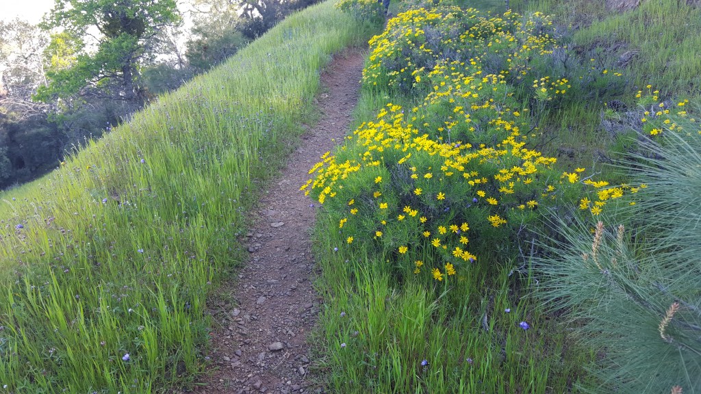
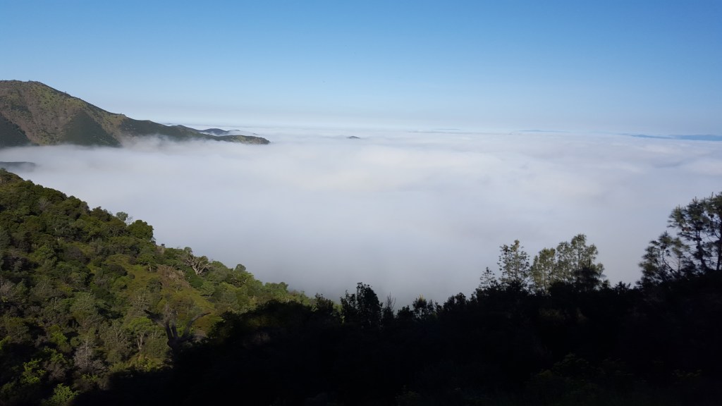
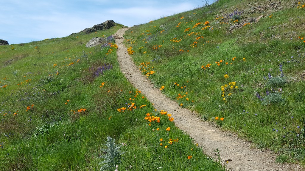
This narrow trail going up to Mount Olympia has some tremendous views of the clouds below. You pick a right day, and right season and you are in for a visual treat.
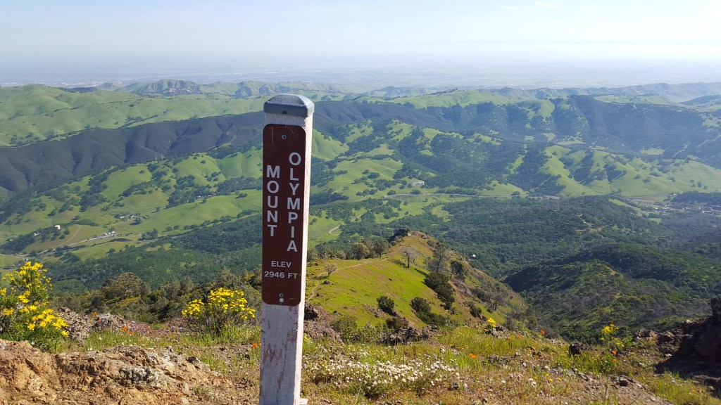
Once we soaked in the views, we proceeded towards the junction of Mount Olympia Road (unsigned trail junction). We took a right turn here towards Mount Olympia until we reached the Zippe trail junction. At the junction you can chose to stay on Mount Olympia road (which is a wider trail and a steeper one to reach the summit) or take the East trail (a single track trail) that ascends Mount Olympia from the East.
Regardless of which road you take, the ascent is a steep climb and you are rewarded with some fantastic views.
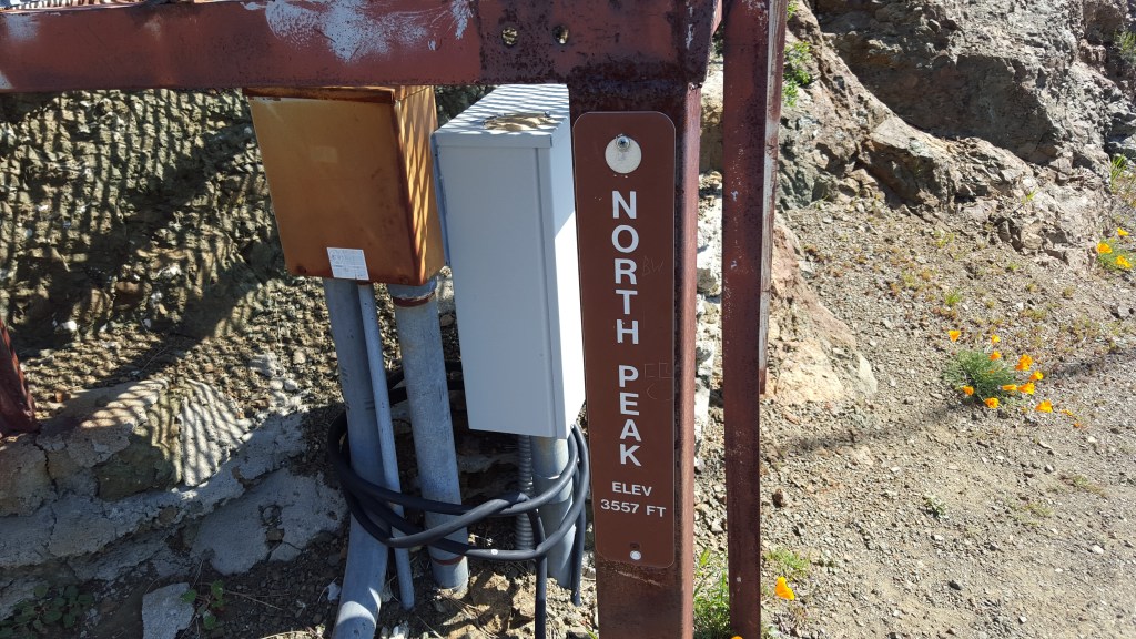
After taking a well deserved break, our job was only 25% complete, as we still had North Peak and Mount Diablo to summit. From Mount Olympia, we followed the North Peak Trail which initially descends, and has a gradual ascent until you reach the junction of North Peak road. At the junction you can take the North Peak Road to the top of North Peak, or head towards Mount Diablo. If you do decide to go towards North Peak, remember the road is way too steep and there are no views on top of North Peak.
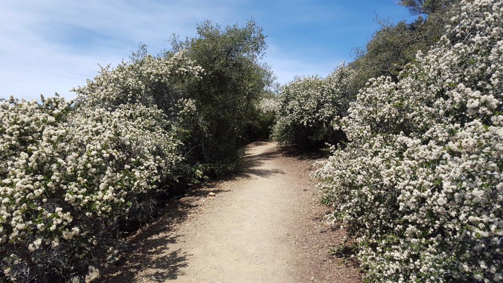
We headed towards North Peak and it took us close to 45 minutes to be back at the junction and head towards Mount Diablo. From here the trail descends about 500 feet until the junction of Prospectors Gap Road. From the junction we took the summit trail to Mount Diablo. The summit trail to Mount Diablo is beautiful and has some amazing views early Spring.
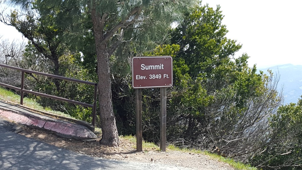
The final stretch to Mount Diablo runs along the paved access road to Mount Diablo. The trail is usually crowded with people at this point. It took us about 3 hours and 45 minutes to get to the summit. We took a much needed break at the summit and enjoyed well deserved ice creams (don’t forget the ice cream that is sold here is inside the summit museum downstairs).
We took a 15 minute break and started to head down towards Regency Gate. We followed the summit trail back to Prospectors Gap Road, which was an easy descent. Anyone who has dared to do the 3 peaks and has stopped at this junction knows very well, that the next descent is much harder than the ascent. The descent from Prospectors Gap (if you decide to take Prospectors Gap Road) is very steep, and there were occasions where several people from our group skid and hurt themselves. If you are ever contemplating to take this route to descend THINK TWICE!
The downhill is brutal on your knees, even when you have hiking poles supporting your weight. There are 2 alternatives to taking Prospectors Gap Road; skip the entire steep descent (by taking Bald Ridge Trail) or part of it (by taking Back Creek Trail). We braved our way and proceeded with the steep descent until it reached Donner Canyon Trail Road. At the junction we took a left and followed it back the same way we came in.
It took us 6 and half hours to finish the entire hike (our previous one took us 8 hours, so we were happy), and our various smart phones and watches put the distance between a good 15 to 16.5 miles. There is always going to be a debate as to why the numbers don’t match, but anything over 14 miles a day just stops the counter at 14 🙂
Difficulty – Strenuous Insanity Level – 2.5 Distance ~ 15 miles Elevation ~ 3900 ft Time ~ 7 hours
Directions: Regency Drive/Gate (Clayton) – Donner Canyon Trail Road – Mount Olympia Trail – Mount Olympia Trail or East Trail – North Peak Trail – North Peak Road – Summit Trail – Prospectors Gap Road – Donner Canyon Trail Road – Regency Drive/Gate

Leave a comment