There is only one thing that comes to mind when thinking about Mount Whitney, there really are 99 switch backs if you ever decide to do it! Hiking up the tallest mountain in contiguous United States is no joke, especially if you are determined to do it as a day hike. The reward of doing this arduous hike is the joy you will feel when you are on the top 🙂 I have had 4 successful hikes up Mount Whitney; 3 as a day hike and the other as part of my JMT hike. I have also made a failed attempt to hike Mount Whitney, when mother nature forced me and our group to end our hike half way. If the Smithsonian hut is in your vicinity, don’t give up, that is the top of Mount Whitney!

Most of our hikes usually start early in the morning when the sun is out, but Mount Whitney was different. We barely had any sleep when all our alarms started to go off at 1 am! The average time to complete the hike was about 20 hours so we knew we had to start early. We packed our bags and headed towards Mount Whitney Portal which was the starting point of our hike. The first section of the hike was to reach Lone Pine lake, which is the only part that is less tiring.
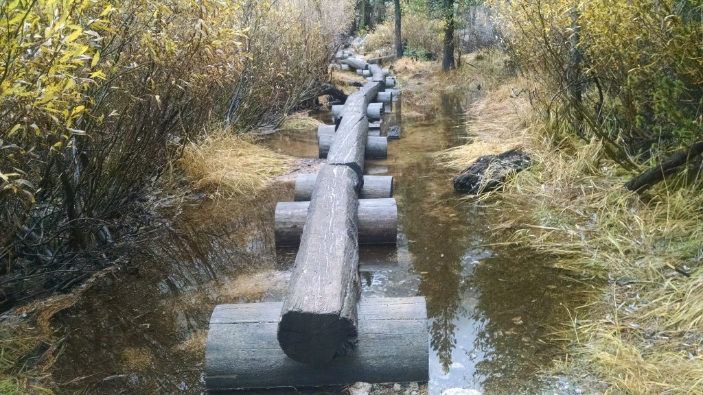
The entire hike has a constant elevation gain with barely any flat stretches required to breathe. We began our hike around 2:30 am with our flashy headlights and started to ascend the trail. The hike up until Lone Pine is gradual elevation gain on solid ground surface. A wooden log crossing over a stream is the first indication that you have almost reached Lone Pine Lake. We couldn’t see anything in the dark, but this part of the trail until you reach Lone Pine Lake has trees on both sides.
(The below pictures are from the failed attempt to hike Mount Whitney)
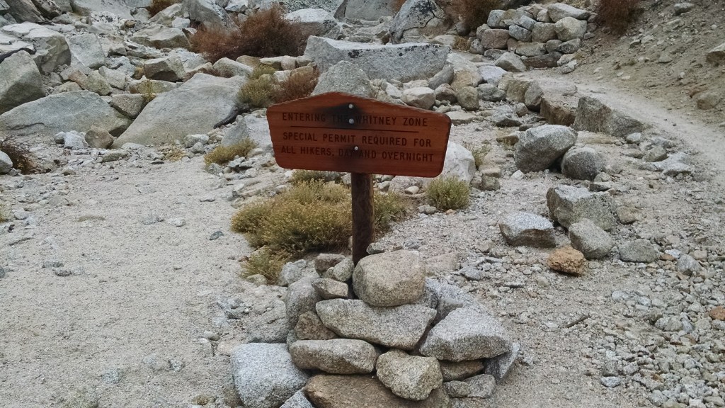
From Lone Pine Lake, you take the Mount Whitney trail towards Outpost camp. As you cross Lone Pine Lake you will notice sign boards for Whitney Zone, this is the zone where you need to pack everything away and put those wag bags to use if you need to. The trail from Lone Pine Lake picks up decent elevation gain through some switchbacks until it reaches Outpost camp. Outpost camp is a good campground if you have more time, and have secured permits to camp. From Outpost camp you climb up a mountain and reach Mirror Lake. A Mirror Lake that is full would make for perfect reflections of mountains on the other side. As we passed by Mirror Lake we could see first signs of sunrise and decided to take a break and enjoy the sunrise.

After our brief break around Mirror Lake we continued on the trail towards Trail Camp, which is where most of the backpackers camp before ascending Mount Whitney with an overnight permit. To reach Trail Camp from the bottom of Mirror Lake you will need to make a couple of mountain hops before reaching Trail Camp. Trail Camp is about 6 miles from Whitney Portal, and you have about 5 more miles left to Mount Whitney. Trail camp is also the last source of water, so we filled our camelbacks here with enough water for the round trip. There is one more water source at the beginning of the switchbacks but trail camp is a better bet. We took a 30 minute break at trail camp as some of us in the group were already feeling exhausted.

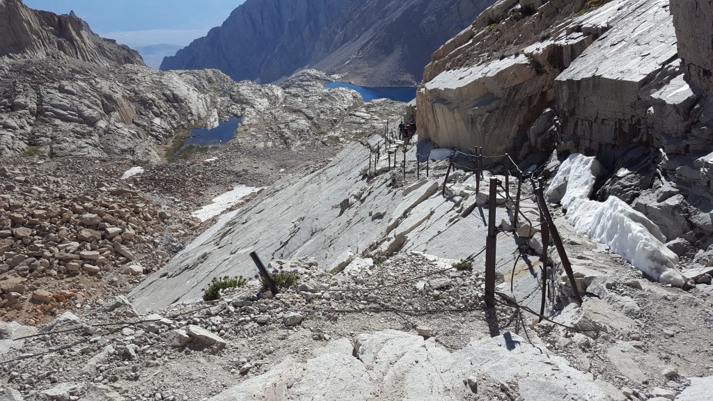
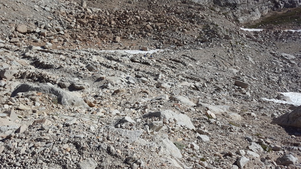
It took us close to 5 hours to reach trail camp and the hardest part of the hike was right in front of us. The stretch of trail from Trail camp to Trail crest is arguably one of the hardest stretches I have done (a few others like Glenn Pass and Golden staircase do make that list). This is the stretch where you need to cross the infamous 99 switchbacks which takes some serious toll on your spirited soul! There is a small section on the switchbacks where there are guard rails, as the snow in this section melts late and its slippery. Everyone in our group had different pace going up the switchbacks, and we wouldn’t meet each other until we were on top of Mount Whitney. It took me about 2 hours and 15 minutes to reach Trail Crest, from Trail Camp.
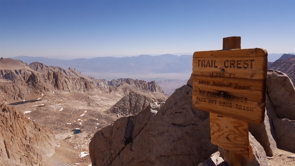
From Trail Crest, the trail descends about 200-300 ft where Mount Whitney Trail intersects with JMT. This is the place where JMT backpackers decide to leave their heavy backpacks and ascend the rest of the trail. Be careful if you decide to leave your backpacks here, as the Marmots here will chew through anything. As you cross the junction you will see a warning sign letting you know to proceed with caution. This part of the trail traverses on granite rocks and makes it very slippery when it rains. If you see any signs of the listed conditions (on the photo below), take a rain check. People have died because they ignored the sign and took the risk; trust me, its not worth your life!

As you hike along the section of granite rocks, you come across some beautiful window like sections that make for some amazing views. The trail gains some decent elevation before you could see the Smithsonian Hut. If you see the hut in your vicinity that will lift any hopes of not making it to the top.

The final stretch of ascending Mount Whitney is hiking the western ridge of the mountain itself. This stretch of trail offer no views, but keep hiking up and you will eventually see the Smithsonian Hut. If you are able to see the hut, then the top of Mount Whitney is not too far. As you approach the hut you will see a weather proof trunk that holds your precious signatures letting everyone know, you have made it to the top of contiguous United States, and you can pat yourself on the back for it. You can walk around, soak in the amazing views and be proud of yourself.

Like with any hike, getting to the top is only half of it, and with Mount Whitney getting to the top is less than half of it. I reached the summit around 12:45 PM and did not start to descend until 2:45 PM, which was about 30 minutes after everyone in the group made it to the summit. The initial stretch of descent is through the same granite rocks which are brutal on your feet and knees. The switchbacks didn’t seem to like us either as they were equally harder while getting down. We reached Trail Camp and decided to take a break, so we can regroup and continue the descent together. There is one thing that I like about our group, we stick together when we know it matters and it helps us all!
As we descended from Trail Camp we were waiting for the section of granite rocks to end so we could feel our feet again. We were dragging our feet until we reached Lone Pine Lake, which is when we started to feel reenergized. Most of the group was pretty tired at this point and already had their flash lights out. Thanks to five hour energy and red bull, I still had the energy to descend and not fall asleep on the trail. By the time we reached Whitney Portal it was close 10.30 PM, and would have loved a Chauffeur service to drive us back (but that was not the case). Even today, When I look back, I would not hesitate to do the hike again, but then may be an overnight permit would help!
Difficulty – Strenuous Insanity Level – 5 Distance ~ 22 miles Elevation ~ 6200 ft Time ~ 21 hours
Directions – Mount Whitney Trailhead – Mount Whitney Trail – Lone Pine Lake – Outpost Camp – Mirror Lake – Trail Camp – 99 Switchbacks – Trail Crest – JMT Junction – JMT towards Mount Whitney – JMT Junction – Trail Crest – 99 switchbacks – Trail Camp – Mirror Lake – Outpost Camp – Lone Pine Lake – Mount Whitney Trailhead

Leave a comment