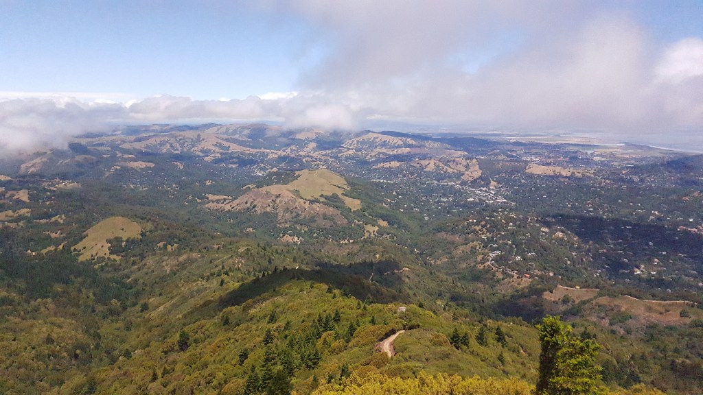
What better way to enjoy the bay area, than a hike that includes the famed Mt Tam and Dipsea Trail, both packed into this wonderful experience. The views from a top of Mt Tam are some of the best you can see around the bay area. Though the hike doesn’t gain a lot of elevation, the distance at 15 to 16 miles surely makes it for a longer one. Like most of the trails around bay area this is an all weather trail, and any season would give you some beautiful views to enjoy.

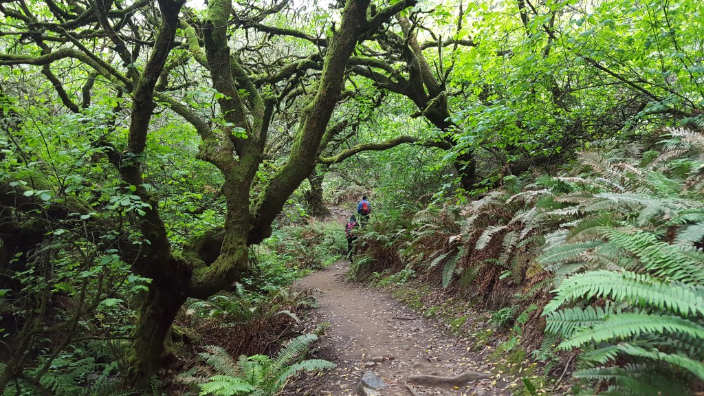
The hike starts from Dipsea trailhead located in Stinson beach. Its challenging to find parking at the trailhead as its limited, and most of the beach parking isn’t open until later in the day. The trailhead is situated close to Stinson beach fire station which serves as a good referral point if you park nearby. We started out on a foggy morning when there was a light drizzle. Dipsea trail begins to climb quickly along the grassy sidelines, and you can start to see views of the coastline as you go up. About 1 mile into the hike Dipsea trail connects with Steep Ravine Trail, which is where you part ways with Dipsea and head up using the Steep Ravine Trial.
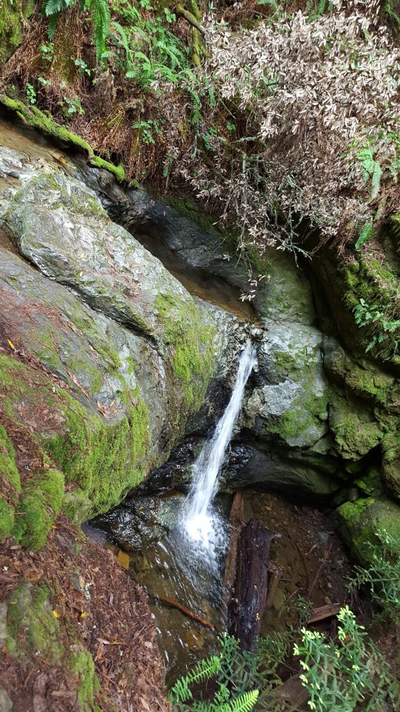
We continued on Steep Ravine Trail for the next 2 and 1/2 miles and were in awe of the beautiful trail. The trail is green and surrounded by big redwood trees, with the Webb creek flowing right next to the trail. There are wooden footbridges on the trail, narrow trail crossings and to top it off a little ladder section that can be slippery on a rainy day. Steep Ravine Trail gains some elevation before reaching the Pantoll campground.

From Pantoll campground there are many trails that lead to Mt Tam. We followed the Matt Davis Trail which was more popular. Matt Davis Trail is across the Panaromic Highway so you will need to cross the road to access the trail. Be careful to not go south as you will end up going towards Stinson beach. Keep following Matt Davis trail as it gains elevation and runs in parallel with Panaromic highway, until you reach the junction with Nora Trail. Continue on to Nora Trail and you will arrive at the West Point Inn within half a mile. The historic West Point Inn has been around for years and offers cabins for rent. We took a break at this junction before proceeding towards Mt Tam.
From West Point Inn, we followed the Old Grade road to the left of West Point Inn towards Mt Tam. At the end of Old Grade road is a gate which guards Ridgecrest road that connects to East Peak of Mt Tam. We continued on Old Grade Road until we reached the parking lot of Mt Tam. From the parking lot you will need to ascend the trail towards Mt Tam East peak where you can get some amazing views of the bay. Most of the trail from West Point Inn to reach Mt Tam has minimal elevation gain and is less tiring than the initial sections on the hike. It took us about 4 and 1/2 hours to reach the peak.
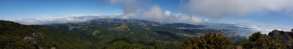
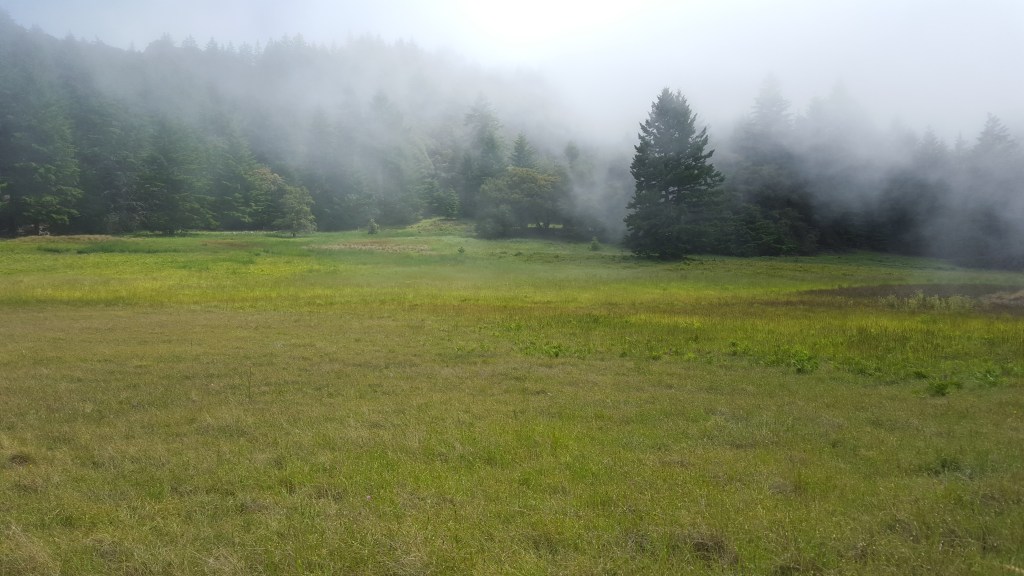
We spent about an hour on top of the peak soaking in the views and munching on our snacks. We started to descend down around 1:30 PM and had about 8 more miles to go before reaching Stinson beach. We followed a different trail while coming down which was much more beautiful than the one we took coming up from West Point Inn. As we descended from the peak we took Old Grade Road until it reached the junction of Middle Peak Road. From Middle Peak Road we took the Lake View Trail, and then International Trail/Northside Trail before ending up at Potrero Meadows Trail. Potrero Meadows Trail has some beautiful views of the meadows and is on flatter ground which is more relaxing.
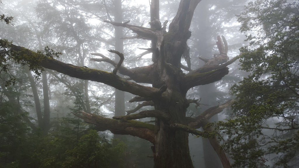
From Potrero Meadows Trail we took the Laurel Dell Road until it reached Ridgecrest Blvd. Our original plan was to take Coastal Trail and then Matt Davis Trailhead, but given that we had less time we decided to change our plans and continue on Willow Camp Fire Road. Willow Camp Fire Road has some steeper descends but is beautiful, and the fog made it much more scenic.
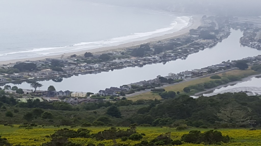
As we descended down, we got a glimpse of much awaited beach views and knew we were closer to ending the hike. Since we changed plans we ended up about half a mile from our parking location and had to drag ourselves the final stretch. It was a tiring hike as we ended up hiking much more distance than we anticipated, but it was totally worth the effort.
Difficulty – Difficult Insanity Level – 2.5 Distance ~ 17 miles Elevation ~ 3000 ft Time ~ 9 hours
Directions: Dipsea Trailhead (Stinson Beach) – Steep Ravine Trail – Pantoll Campground – Matt Davis Trail – Nora Trail – West Point Inn – Old Grade Road – Mt Tram East Peak – Old Grade Road – Middle Peak Road – Lake View Trail – International Trail – Northside Trail – Potrero Meadows Trail – Laurel Dell Road – Ridgecrest Blvd – Willow Camp Fire Road – Dipsea Trailhead

Leave a comment